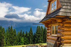


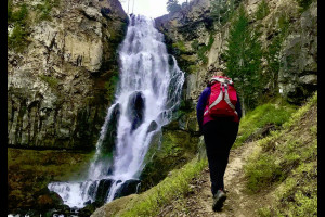
- The potential for hiking and backpacking in the Bozeman area is endless and inviting.
- Outfitters and guides in the Bozeman area specialize in a variety of spring, summer and fall trips that include day hikes, as well as backpacking trips.
Overview
From a simple hour hike to half a day, from a full day hike to a backpacking trip, this easy activity can be enjoyed by all ages and all experience levels. The potential for hiking and backpacking in the Bozeman area is endless and inviting.
Where to go Hiking/Backpacking
The following information concerning trails in the Gallatin National Forest is provided by the Gallatin National Forest Service.
Absaroka Mountain Range
- South Fork Six Mile -
10 miles in length.
Light use
Elevation 6000' - 9654'
Access road - Daily Lake Road
Conditions - Fair, boggy near creek
Must hike in 3 miles on private road to reach trailhead or get owner's permission. Well graded, good backpacking trail, though not well marked near pass. - Elephanthead -
4 miles in length.
Light use
Elevation 6080' - 9160'
Access road - Mission Creek Road through 63 Ranch
Conditions - Good; boggy in spots near pass.
High-clearance 2W drive access through private land; follows Mission Creek, connects with FS #45 - Blacktail Creek. Excellent view of the area throughout; alpine meadows. Elephanthead is climbable without equipment. - South Fork Deep Creek -
5 miles in length.
Light use
Elevation 5920' - 9112'
Access road - Deep Creek Road
Conditions - Good; boggy in meadows
Well-graded trail follows cascading creek; very pretty throughout. Connects with Davis Creek over the Divide. - Mill Creek Pass -
5 miles in length.
Light use
Elevation 7012' - 9403'
Access road - 6 miles up #51
Conditions - Fair to Poor
Crystal Cave is located 112 mile up the trail (6 1/2 miles from trailhead) Trail connects with West Boulder over pass. - Suce Creek / Baldy Basin -
9 miles in length.
Light use
Elevation - W 5400'- 8400' E 6080'- 8400'
Access road - West Baldy/East Baldy Divide East Mission Creek Trailhead
Conditions - Fair to Poor especially at the pass
The west side initially follows an old Jeep road, and at a later point parallels a water pipe; some cattle grazing; steep up to the pass. - North Fork Deep Creek -
6 miles in length.
Light use
Elevation - 5800'- 9000'
Access road - Suce Creek Road
Conditions - Fair, easily lost in meadows
Trail stays well above the creek; carry water. Scenic in alpine meadows, some livestock grazing. - Pine Creek -
5 miles in length.
Heavy use
Elevation - 5626'- 9032'
Access road - Pine Creek Campground
Conditions - Good; several rocky areas
Very scenic trail ending at an alpine lake, glacial basin. Steep, allow 4-5 hours with backpack. Pine Creek Falls are located 1 mile up the trait for a shorter hike. - Elbow Lake -
6 1/2 miles in length.
Medium use
Elevation - 6000'- 8630'
Access road - 1 1/2 mile up Trail 51
Conditions - Good, rocky and boggy near lake
A lot of variation - meadows, creeks, views of surrounding mountains; ending in a high mountain lake. Trail climbs to 8500' twice. Access for climbing Mt. Cowan. - East Fork Mill Creek -
12 miles in length.
Medium use
Elevation - 5760'-9673'
Access road - East Fork Mill Creek Road
Conditions - Good
Follows the creek with an easy grade, steep up to Silver Pass. An enjoyable trail that passes through limestone cliffs, meadows. - Anderson Ridge/Jomaha -
14 miles in length.
Light use
Elevation - 5760'-8527'
Access road - Mill Creek Road
Conditions - Fair to Poor
Good Wilderness trail. Be sure to bring compass and topography map as the trail is poorly marked. Ridge top views throughout. Carry water. - Mill Creek -
4 miles in length.
Light use
Elevation - 6500'- 8000'
Access road - Lambert Creek on logging roads at the end of Mill Creek Road
Conditions - Poor to Fair
Follows old logging road first mile. Bring topography map. Old section of trail leads from bridge at the end of Mill Creek Road and beginning of logging roads. Leads to Crow Mountain. - Wallace Creek -
8 miles in length.
Heavy use
Elevation - 6000'- 9769'
Access road - Mill Creek Road {Passage Falls)
Conditions - Good, rocky near pass
Good grade though steep at pass. Heavy use by outfitters to reach Grizzly Creek. Follows creek and opens into beautiful alpine country. Falls are located on a side-branch into private land. - Passage Creek -
7 miles in length.
Light use
Elevation - 6500'- 9530'
Access road - 3 miles up FS #58
Conditions - Fair to poor, easily lost in meadows
Less used route to the alpine plateaus of the Gardiner District. Good wilderness trail. - North Fork Six Mile -
10 miles in length.
Light use
Elevation - 6000'-9654'
Access road - Daily Lake Road
Conditions - Fair
Three mile hike to trailhead, then follows an old jeep road. Not well maintained and crosses creek several times. - West Fork Mill Creek to Monitor -
9 miles in length.
Heavy to Light use
Elevation - 6400'- 9654'
Access road - West Fork Mill Creek Road
Conditions - Poor to good. Many boggy spots first 3 miles
Horse travel to Thompson Lake turn off. Lonesome Pond and beautiful alpine meadows near Monitor. - Emigrant Gulch -
5 miles in length.
Medium use
Elevation - 6000'-8000'
Access road - Chico
Conditions - Good
4W-drive road first 3 miles. - Highland -
1 1/2 miles in length.
Light use
Elevation - 6000'-7200'
Access road - 1/4 mile up FS #51
Conditions - Poor to Fair
An access to Anderson Ridge FS #54. A little hard to find initially, but easy to follow later. - Moose Park -
6 miles in length.
Light use
Elevation - 7250'-8500'
Access road - 1 mile up FS #55
Conditions - Fair but boggy
Though access is poor because FS #55 is so poorly marked, It does connect with FS #54 and #51. - Colley Lake / Lambert Creek -
10 miles in length.
Light use
Elevation - 7000'-9000'
Access road - Lambert Creek on logging roads at the end of Mill Creek Road. Another access via Colley Creek
Conditions - Fair, easy to get lost in meadows
Trail indistinct first 200 yards. No fish In Colley Lake. Good wilderness trail. Bring topography map with compass. - Thompson Lake -
3 miles to Lake
5 miles to Pass
Heavy to Medium use
Elevation - 7000'- 7900'-Lk 9600'-Ps
Access road - 4 miles up FS #61 (West Fork Mill Creek)
Conditions - Fair, many boggy areas
Horse traffic. The trail follows creek to the lake , then up to Horse Creek Divide and Gardiner District trails.
Gallatin Mountain Range
- Gallatin Divide, Devil's Backbone -
27 miles in length.
Medium use
Elevation - 8800'- 10,300'
Access road - The top of most Gallatin Range trails
Conditions - Fair, trail is mostly un-marked
Extremely beautiful; alpine meadows and ridge top views. Dangerous for horse travel between Cliff Creek and Hyalite. - Bark Cabin -
6 miles in length.
Light use
Elevation - 6000'- 9600'
Access road - 6 miles up FS #180
Conditions - Fair
Follows cascading stream through many meadows. - Meadow Creek -
3 miles in length.
Light use
Elevation - N 8400'-8900' S 7799'
Access road - End of FS #180
Conditions - Fair
Continuation of Big Creek Trail FS #180. Connects to #FS 178. - Rock Creek -
6 miles in length.
Light use
Elevation - 6800'-9300'
Access road - Rock Creek Road
Conditions - Fair
Scenic upper and lower meadows. Used heavily by hunters in the fall. - Big Creek -
12 miles in length.
Medium use
Elevation - 5850'-8400'
Access road - Big Creek Road
Conditions - Good, boggy near top.
CLOSED TO MOTORIZED VEHICLES. Pretty throughout meadows, rock cliffs, and talus slides. Heavily used by hunters in the fall. - Windy Pass -
3 miles in length.
Medium use
Elevation - 7900'-9200'
Access road - 10 miles up FS #180
Conditions - Good
Scenic alpine plateau at divide, connects with FS #96. - Cliff Creek -
6 miles in length.
Light use
Elevation - 5900'- 8800'
Access road - 1 mile up FS #180
Conditions - Fair
Trail follows creek within many steep canyon walls. Connects with Divide Trail FS #96. - Trail Creek -
6 miles in length.
Medium use
Elevation - 5800'- 6800'
Access road - Trail Creek county road
Conditions - Good
Trail goes to Trail Creek cabin then to divide and down to Bear Canyon.
Crazy Mountain Range
- Grasshopper Glacier -
5 miles in length.
Heavy use
Elevation - 6800'- 8800'
Access road - Cottonwood Creek Road
Conditions - Good, boggy in meadows
First half is a private-use road. The trail leads via several steep climbs to an alpine lake and glaciated basin. Good day hike connects with FS #268. - Smeller Lake -
2 1/2 miles in length.
Medium use
Elevation - 7000'-9884'
Access road - 7 miles up FS #270
Conditions - Fair
Beautiful stream, lake, basin, and meadows. Steep. Last mile not recommended for horses. Good back country trail. - South Fork Shields and Lowline -
9 miles in length.
Light use
Elevation - 6800'- 8000'
Access road - Porcupine Road and Station
Conditions - Fair, easily lost in meadow
Rangeland and grazing. Indistinct at the beginning. One access to FS #273k - Trespass Creek -
5 miles in length.
Heavy use
Elevation - 6800'-8600'
Access road - Cottonwood Creek Road (1-mile private-use road)
Conditions - Fair
Easy grade through scenic meadows and forest. Leads to Campfire Lake trail. No cars on private-use road. - Rock Creek North -
10 miles in length.
Light use
Elevation - 6800'. 8775'
Access road - Call Forest Service Office
Conditions - Fair
Very scenic waterfalls, meadows and lake. Some steep grades and several stream crossings. - Sunlight -
3 miles in length.
Medium use
Elevation - 7000'. 9280' Lake is 8961'
Access road - Call Forest Service Office
Conditions - Fair, rocky near pass
Ascends ridge and drops into alpine lake and basin. Beautiful views throughout. Loose and steep at pass. Connects to North Fork Sweetgrass Trail (Big Timber).
Contact Info
For more details contact:
Bozeman Ranger District
3710 East Fallon St.
Bozeman MT 59718
406-522 2520
Livingston Ranger District
5242 Highway 89 South
Livingston, MT 59047
406-222-1892
Gardiner Ranger District
PO Box 5; Highway 89
Gardiner, MT 59030
406-848-7375
Rentals & Fees
The Gallatin National Forest is a federally managed public land. As such, there is no fee for the use of the various hiking and backpacking trails.
If you are in need of any equipment to make your trip easier, Bozeman has many hiking/backpacking stores where you can purchase needed supplies or rent equipment.
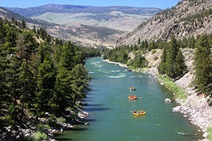
Hire a Guide
Outfitters and guides in the Bozeman area specialize in a variety of spring, summer and fall trips that include day hikes, as well as backpacking trips. Many offer “drop camps” where they pack in your supplies – while you hike in - and then drop you and the supplies off, to allow you to enjoy 3-5 days in the backcountry.
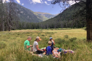
Guided day hikes give you the opportunity to experience the wonders of the local area through the professional knowledge of your guide, have lunch and then return before the day is over.
Guides and outfitters can educated you on the floral and fauna of the area, and point out scenic sights, wildlife, and natural wonders that you may have otherwise missed.
Trail Etiquette
- ALWAYS stay on a designated trail.
- Learn to share the trails with all other users. In general, bike riders yield to both hikers and horseback riders; hikers yield to horseback riders. However, for all trail users, downhill yields to uphill.
- Use common sense and courtesy while on the trails. Announce your intentions and slow your pace when passing someone on the trails.
- Do not litter.
- Do not chase or harass wildlife.