


- The 240-foot white rock "M" was created in 1916 by MSU students.
- The “M” trail is accessed via the trailhead at Route 86 in Bridger Canyon and is managed by GVLT (Gallatin Valley Land Trust)
- The right fork leading to the M is steep, following the ridge. The left fork is a kinder, gentler ascent, via switchbacks.
Overview
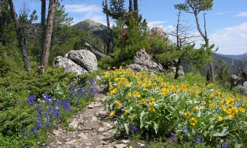
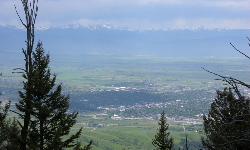
Race up to the “M” with your whole family or hike the mile and a half M-trail leisurely and enjoy a romantic picnic at the top with a spectacular view of Gallatin Valley. The “M” stands for Montana State University and the 240-foot white rock letter was created in 1916 by MSU students. The right fork leading to the M is steep, following the ridge. The left fork to the M is a kinder, gentler ascent, via switchbacks.
Location/Directions
Located on the south side of Baldy Mountain overlooking Gallatin Valley, the “M” trail is accessed via the trailhead at Route 86 in Bridger Canyon. The “M” rock letter formation sits about 6,000 feet high from the roughly 5,000-foot high trailhead.
Seasons
Winter can make hiking the M more difficult due to low temperatures and snow so take any necessary precautions and wear appropriate gear. Early summer through fall is the most popular time to hike the M and hikers are advised to bring water, a hat, wear sturdy shoes, and watch for sliding rock. Dogs are allowed on the trail, with refuse stations (and bags) placed at the base of the hike.


